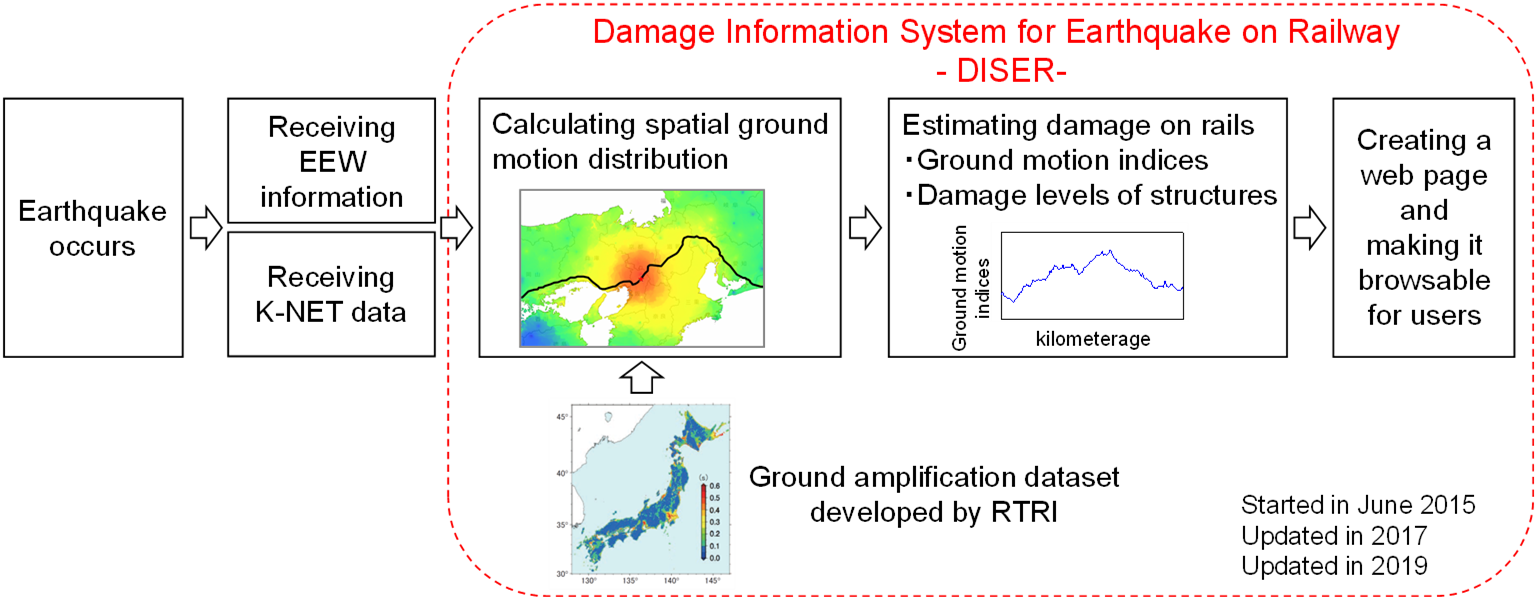
DISER , Damage Information System for Earthquake on Railway
This system provides the ground motion distribution and the damage levels of structures along rails estimated immediately after an earthquake, based on the earthquake data transmitted by public agencies.
The decision on when to resume train operation and when to conduct inspections can be made quickly and effectively by using the information provided by DISER.
It is also possible to set up a customized system tailored to each operator’s need.
Features
Real-time estimation of the ground motion distribution
The data on ground motion indices observed at K-NET, a nation-wide seismic observation network in Japan operated by the National Research Institute for Earth Science and Disaster Resilience are used. The K-NET data are transmitted via dedicated network just after an earthquake.
Stepwise disclosure of ground motion distribution
The ground motion distribution is firstly calculated based on the earthquake early warning information disseminated from Japan Meteorological Agency using attenuation relation, and then based on the interpolation of the K-NET data. The information based on the K-NET data is issued about 7 minutes after earthquake in average.
The spatial ground motion distribution estimated at 500-meter grid points
The spatial ground motion distribution is calculated using the interpolation of the K-NET data, taking non-linear amplification characteristics into account. The database of the ground amplification is developed by RTRI.
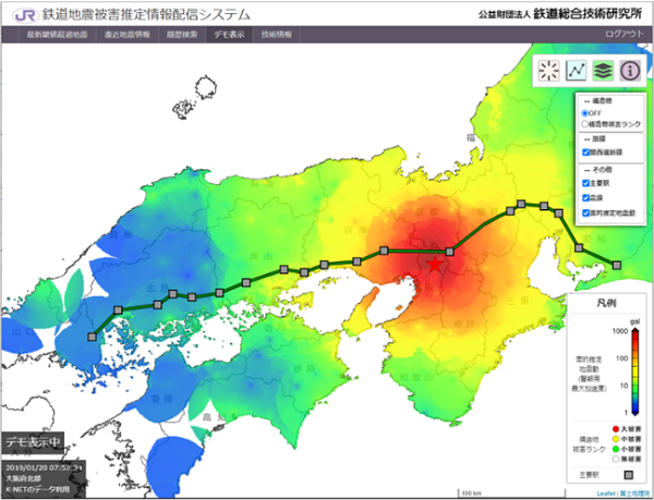 Display of the spatial ground motion distribution
Estimation and display of information along rails
The ground motion distribution along rails is extracted and displayed as the ground motion indices used for the train operation such as 5 Hz low-pass peak ground acceleration, Spectral Intensity and seismic intensity. The damage of structures on rails such as bridge or viaduct is also estimated and displayed as the damage levels.
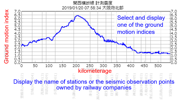
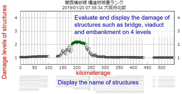 Display of the ground motion distribution and the damage levels of structures on rails
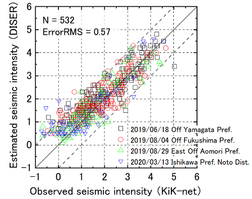
Accuracy of ground motion distribution estimated by DISER
Comparing the estimation data at KiK-net* locations by DISER with observed data by KiK-net, the Error RMS is 0.5 to 0.6 in scale of seismic intensity. It should be noticed that most of the estimates have errors less than 1.0. Estimation accuracy of DISER is very stable.
* KiK-net is another seismic observation network in Japan operated by the National
Research Institute for Earth Science and Disaster Resilience.
 Evaluation of accuracy of the ground motion distribution estimated by DISER
How we can support
・ Consulting Services
Contact; international_development@rtri.or.jp